Wednesday, October 16, 2019

Cyprus E4 European Long Distance Walk: Comments on my trip

Late September and early October was probably not the best time to hike across Cyprus. Vegetation had been dried by the summer sun, dusty yellow and brittle. It must have been green in the spring and full of flowers (see those recorded by a previous blogger). Although later in the year it was still very hot for walking, around 30 degrees in the afternoon, although I was told it was a late heatwave.
While the brochure for the route is no longer available from the Cyprus Tourist Organisation, there are plenty of E4 signs scattered across the country, yellow diamonds with a black E4 in the centre as in Greece. Not enough though, to navigate by, for that you really need to download a track onto your GPS or smartphone (see links on the daily blog pages for the GPS track of my route). I used a Navitracks map of Cyprus on my GPS, but the Europe OSM (Open Street Map) map I had, or indeed Google Maps, was almost as good. I was slightly confused as some signs with the E4 logo point to nearby towns with facilities, but the E4 does not necessarily go to those towns. The frequency of the waymarks various greatly and sometimes only the yellow and white painted poles remain, with ancient snail shells stuck to them.
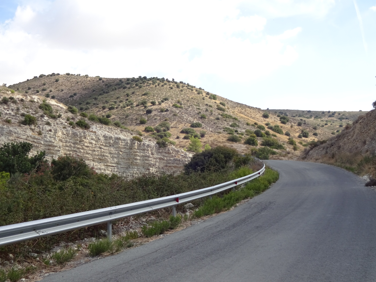
Much of the route is on vehicle tracks, forest and farm roads, surfaced with gravel or white and dusty from the underlying limestone. Tarmac roads, when they are followed, were invariably quiet. There were however some good sections of footpath (monopati), often nature trails with signs naming the vegetation or rocks (although note that at the season you walk in, the named plants may not be visible). Thinking I would be mainly on forest or farm tracks I wore hiking shoes for the first time on a longer trip like this. Probably a mistake as stones, burs and sharp bits of grass easily got into my shoes and/or attached themselves to my socks in a way that required painstaking efforts to remove. A tear which developed in the fabric suggested they would not cover many more kilometres, although they were not some cheap trainers. Next time I will wear boots.
The E4 in Cyprus can be split into three. Firstly, the section from Pafos to Lysos across low hills, among scrub and vineyards, and around the Akamas peninsula. Tourists racing past in motorised buggies, raising the dust, can be a bit disconcerting in places. Best for its villages, which the E4 tends to bypass, they are worth a visit for their coffee shops, accommodation and general atmosphere. Although not on the route, I recommend a visit to the mosaics at Pafos.
The second section is across the Troodos and surrounding mountains. Classic walking country among pines, monasteries and ancient villages, the section from Lysos to Stavrovouni monastery is the best part of the E4 in Cyprus. The route meanders around the mountains so it takes a long time to reach a place that may be only a short distance away. There are certainly quicker ways to cross the mountains but that misses the main objective of visiting places you would not otherwise see, enjoying the scenery and changing patterns of light at a slow pace. Most of the time you will be on your own but at a few popular spots, such as the Kykkos monastery and Kaledonia waterfall, there are plenty of people about.
In the third section, the E4 extends to Cape Greco and then doubles back on itself and returns to the Larnaca area. Others have ended their trip on reaching Cape Greco, and little need be lost by doing this. The area has its interests, the residues of history in the form of the UN buffer zone and the British base, and the resort town of Ayia Napa was more enjoyable than I expected.
The B&B accommodation I stayed in was an unexpected pleasure, a chance to enjoy a traditional house and listen to the owners. Hotels were more predictable. The way some were aimed at the British tourist, was enjoyable in a kitsch sort of way. In the mountain section it is difficult to avoid a few nights of camping, but it has the advantage of seeing the sun rise and set across the pines. Forest campsites and picnic sites, with water and many with toilets, make camping a bit easier.
Long distance walking is not a popular Cypriot activity and I did not meet any other backpackers, but it is an interesting country with a lot of history, old villages and a variety of landscapes so somewhere to consider.

The total length of my walk on the E4 in Cyprus was 555 kilometres (347 miles), including the effect of missed turns and diversions to hotels, coffee shops, monasteries and other sites of interest it was 610 kilometres (381 miles). Click here to go to the start of my blog of walking through Cyprus.

For my whole walk along the E4 from Tarifa in Spain to Larnaca in Cyprus I have walked 10100 kilometres (6315 miles) over the last 5 years, excluding additional options and extensions. I have not skipped any sections using buses, taxis, cars or trains, although as I cannot walk on water I have taken ferries where needed. Below are links to the various sections I have walked:

A report on my complete trip can be found on Traildino.com

I have written a daily blog from Budapest, picking up from the pioneering blog of the E4 by John Hayes on the Tarifa to Budapest section, these are the links:

Walk on Kektura from Budapest in Hungary
Walk on the Alfoldi Kektura in Hungary
Walk through Northern Serbia
Walk through Southern Serbia
Walk through Bulgaria
Walk through Greece (including Crete)

I also walked a possible extension of the E4 from Portugal and heading east after completing the Cyprus section of the E4 I walked the Israel National Trail.

Update: Based on my travels on the E4 I have written a book "Six Pairs of Boots: Spain to Cyprus on the E4 Trail" by John Pucknell available from Amazon.co.ukAmazon.com, the Bookdepository.com, lehmanns.de, bookspot.nl, and other good online bookstores.


Tuesday, October 15, 2019

Cyprus E4: Aradippou to Airport: Day 24

My final day of walking both across Cyprus, and across Europe on the E4. Highlights of my last day of walking were the Kamares aqueduct and the Hala Sultan Tekke mosque by the salt lake.
Rejoining the E4 north of Aradippou, I walked through an uninspiring vista of fields of stubble, rows of round bales of hay, cows herds in large sheds, silos and piles of gravel. Crossing the Nicosia highway on a curiously large bridge brought an improvement. I visited the little church of the Panagia Aimatousa, with its simple barrel vaulted nave and stone walls, and my final viewing of Greek Orthodox icons on this trip. Some road walking brought me to my final "forest", the Rizoelias park. Following the circuitous route up through small pines I reached a viewing point over Lanarca by a picnic site. Then it was downhill, exiting the park into an industrial estate.
After some urban walking with a diversion through ploughed fields (unfortunately attracting some fly tipping), I reached the suburb of Kamares and admired its lengthy aqueduct carried by some 20 graceful arches of yellow stone, built in the 18th century but looking Roman. Leaving buildings behind I crossed open ground to reach the large salt lake, white at the edges, red further in. Beyond it to the east were the buildings of Larnaca, to the south planes landing at the airport.
Hidden at first from my view, the Hala Sultan Tekke mosque shyly revealed itself as I rounded a corner of the gravel track I was following. An important pilgrimage site it is said to contain the tomb of Umm Haram, holy helper and Aunt of Mohammed, who died here during an Arab army attack on Cyprus. Inside the mosque is quite plain but looking back as I crossed a causeway towards the airport, its location beside the salt lake makes it a striking monument.
My final obstacle was to find a way into the airport, not always easy for a pedestrian as you are not expected to arrive on foot, but apart from crossing one busy road, it was all on pavements from the exit road of the mosque. This has just left me with a long wait for my flight back home later this evening, thinking of where my next trip might take me...

21 kilometres walked today. A GPS track of my route can be found on wikiloc.com and on ViewRanger short code johnpon0047.

Kamares aqueduct

Hala Sultan Tekke mosque as viewed from the south, with the salt lake before it.

Monday, October 14, 2019

Cyprus E4: CTO beach to Aradippou: Day 23

A day of houses, half built houses, farmland and large cow sheds, followed by an evening visit to the sea front at Larnaca.
After a Full English Breakfast (the Tsialis hotel was a very British hotel (although a Russian flag was also flying)), I made my way north through quiet streets with concrete villas. After a little farmland there were more villas, many half built. Who will buy them I wonder? Reaching the village of Pyla for the second time this trip, I decided it was too early for a coffee and walked down the road to the next village of Oroklini which I also visited before on this trip. At the latter an obviously ancient church sits incongruously among the modern apartments.
The area is flat or low lying around Larnaca, but beyond Pyla and Oroklini the hills abruptly rise up some 80 metres to a plateau. My route out of Oroklini climbed up the side of this steep hillside on a new road. The Profitis Ilias church is a little off the path, near the summit, but I went the extra distance, only to find it locked. From the outside it looked like an old church with a big, newer extension at the front. Beyond the church was a viewpoint across Larnaca. In the distance lightening was discharging into the sea and the rumble of thunder followed. A few showers swept across, the few raindrops raising the smell of baked earth. I descended the hillside among some small trees and then it was across farmland to the next village of Kellia. More farmland followed, stubble left from harvest or ploughed fields. As I neared Aradippou the smell of manure preceded a number of farms with large herds of cows under huge open sided sheds. A few fans moved the air around.
I am now back at Villa Thermopilon in Aradippou, a kilometre or so south of the E4, where I stayed on my outward trip to Cape Greco.
The owner kindly drove me into Lanarca where I walked along the promenade, an area known as Finikoudes. Too late to visit the fortress, I wandered by it and the adjacent mosque. Eating some vegetarian mezze over a glass of wine, I watched people (and an occasional dog) walking up and down the sea front as the day darkened into night.

21 kilometres walked today with a 230 metre total ascent.

View across Larnaca from the Profitis Ilias picnic site viewpoint, there is distant thunder and squalls of rain.

Promenade of Larnaca in the evening.

Sunday, October 13, 2019

Cyprus E4: Ayia Napa to CTO beach, Pyla: Day 22

A morning's walk by the sea among people enjoying the sun, an afternoon by a quieter, rocky coast and Dhekelia Station.
After a morning latte and croissant in a coffee shop that would not look out of place in any city in the world, I headed west from Ayia Napa, along the paved path that runs beside the sea, joining a few morning joggers (but obviously moving more slowly). Hotels and resorts continued for several kilometres, some well established others currently being built, with one or two small churches, once on lonely headlands, now surrounded by developments. Sometimes I was on a paved path by a rocky shore, other times on a sandy beach, full of sun loungers and blue umbrellas. All kinds of people were stretched out on them: thin and fat, young and old, some brown, some pale, some red. Whether Russian or English they were enjoying a sun that I was finding a little hot. The sand made for slow walking and filled my shoes. I had to divert around a particularly large construction project (Ayia Napa Marina), after which the villas were more low key and people fewer. Reaching a creek where all kinds of boats were moored, I worked my way around it and onto a track passed a planned development (only the road had been built), farms and rough land before joining the road to the village of Xylofagou.
At Xylofagou I briefly joined the route I was on when heading east. I also downed two bottles of lemonade, thirsty as the water I was carrying was now close to blood heat and not refreshing. At the church there was a memorial to some people who had died in the 1974 Turkish invasion. Not the first that I had seen, they seem to have replaced the EOKA memorials erected further west. Returning to the sea, by another church, and a diving class, I had a little difficulty finding the right track down to the shore. Once I did it was several kilometres beside a rocky coastline on a gravel track, with a few pebbly beaches, where the occasional couple or family had parked their car and were enjoying a Sunday by the sea. There was a sign for a "Fisherman's cafe" beside a small harbour with assorted boats. Looking for something cold I looked in. There was coffee, cold water, questions about where I was going and comments on climate change, melting ice at the North Pole, the current heatwave in Cyprus and a friend's cafe in my home town of Cardiff (which was there 45 years ago, the Anastasia,  do you know it?),
Somewhat rested I approached a large power station, with red and white chimneys and was relieved when the tarmac road that I had joined took me around it and onto Dhekelia station. This is a British Military base surrounded by fencing but signage was discrete concerning nationality. The Union flag was flying at one location, the road I was walking along was called Waterloo road, there was a British Legion, a cafe run by a forces charity (where I quickly sank a large coke before it closed) and "No Photographs" signs but nothing explicitly said this is a British Territory.
After leaving the "station" it was a few kilometres more to the Tsialis hotel, where I enjoyed a very welcome, cold beer on the house.

33 kilometres walked today, a coastal section with no height gain. A GPS track of my route can be found on wikiloc.com and on ViewRanger short code johnpon0047.

One of many resorts whose beaches I walked across

New building in progress

The quieter rocky shore after Xylofagou

Saturday, October 12, 2019

Cyprus E4: Around Cape Greco: Day 21

A hike through scrubland to the tourist resort at Konnos and onto Cape Greko, followed by a return to Ayia Napa walking beside the sea over rough limestone rock or along beaches.
I climbed out of town then followed roads and gravel tracks through an area of large bushes, exposed rock and an occasional Eucalyptus tree. I passed a military base, lots of aerials, some houses, an isolated church and no people. On reaching Konnos and the coast, the scenery changed dramatically. There were hotels, bars, a beach full of blue umbrellas and lots of people, usually in swimming costume, some looking fit, others with a lot of flesh wobbling as they walked. Tattoos seemed popular for men and women. As I sat down for a lemonade and ice cream, the lady at the next table had a tattoo down her spine telling me "you don't need a plan...", but the rest of the tattoo, lower down her back, was hidden by the back of the white plastic chair, so I am not sure what I did not need a plan for. Nor was she speaking English.
Finding the path out of Konnos was a little difficult, it took me while to realise it runs straight through the cafe, but once on the footpath it skipped up and down with signs identifying the different plants. The path led to a small church and below it the cave of Ayioi Anargyroi. People were jumping off the cliff into the sea. Not something I could recommend due to the risk of hitting a rock. However with the cool blue sea on a hot day like today I could see the attraction. A little further on there was one of a few natural arches on the coast that I would pass. I continued heading east until a fence prevented further progress. Beyond it there was what I took to be a military establishment with multiple aerials. So having reached the most easterly point on my trip on the E4 in Europe I sighed and headed west along the coast.
The E4 follows a footpath over rough limestone, the sea was to my left, with boats full of tourists on trips from Ayia Napa, on my right cliffs rose above me. I had to be careful to follow the trail, as the passage of feet had smoothed the sharp edges of the limestone, elsewhere it was unpleasant to walk on, slow dissolution by the rain having created a spiky surface. In time I reached the point at which the path was crudely paved, making progress easier. By now the cliffs had gone and resorts began, with their sun loungers, umbrellas, bars and areas of too green grass, kept that way by frequent watering.
After some distance on the paved path, it was time to follow the beach, avoiding people sunbathing and the carefully constructed sand castles (and a sand crocodile). The beach stopped at Ayia Napa harbour and a little further along the promenade I turned inland among the shops and bars to Barbara's apartments, a rather more modest place to spend the night compared with the resort hotels I had walked by.
In the evening there was a medieval festival. People lined the street waiting for the parade. The wait was eventually rewarded. People dressed in costumes pillaged from history slowly moved up the street, beating drums with tremendous stamina, blowing trumpets, throwing flags and swinging fire around their heads. Some were dressed for a masquerade, others on stilts wore fantastical costumes. Young school children waved in period costume. Speeches by worthy dignitaries seemed about to follow the procession so as people dispersed I left to eat in a Japanese restaurant. I chose it as other restaurants seemed to have been filled either by those who had been watching the parade or else the usual Saturday night crowd. Later there was a crooner singing on a stage in the square but I had an early start in the morning so I climbed back up the hill to my rooms.

25 kilometres walked today starting and finishing at my hotel. A GPS track of my route can be found on wikiloc.com and on ViewRanger short code johnpon0047.

Beach at Konnos

Path back to Ayia Napa along the coast

Natural arch near Ayia Napa

Part of the Medieval festival parade, these drummers really had stamina!

Friday, October 11, 2019

Cyprus E4: Xylofagou to Ayia Napa: Day 20

Unless you had an interest in Market Gardening, this morning's walk was not going to be exciting. This afternoon included the Sotira "forest", although forest was perhaps too generous a term.
Needless to say the taxi I arranged for 9:30 a.m. did not turn up until after I rang him up 10 minutes later to remind him. So after a slightly late start I began my walk from Xylofagou. This morning I walked over the flat farmland of the coastal plain, an area of rich, reddish brown soil. In addition to fields of stubble where some grain had been harvested, there were fields of potatoes, kept green by water sprays rhythmically sweeping back and fore. A couple were out planting cabbages in neat rows. Long "greenhouses" with clear sheets of plastic for their roofs and "walls" of fine netting where being used to grow tomatoes and cucumbers. Other vegetables being grown I could not identify. There were some classic steel, farm wind mills used to pump water out of the ground but I have read that most of the water used for irrigation in this area now comes from reservoirs in the mountains.
In the afternoon I reached the Sotira forest. An area of marginally higher ground where the limestone rock is close to the surface. There were not many big trees, most were like bushes. A picnic area was close to the highest point in the area. Two churches hid beneath the summit, a more modern looking one in front of a stone built one that looked older. The stone church was in turn in front of a shallow cave with a bench. Climbing the rocks to the summit behind the churches afforded a good view of the coast and the town of Sotira inland, although it was scarcely a picturesque scene. As I walked among the Eucalyptus trees down to Ayia Napa, a pick up stopped and the man checked that I was not experiencing any problems, before returning the way he had come from. I doubt many people walk this section, it seems to have little to recommend it and on a hot day like today, a cool shower in my hotel seemed a much more attractive activity.
I had come across no GPS track of today's route in my research and had made my own based on the Cyprus Tourist Organisation leaflet. I spotted a few signs, and some yellow and white posts that once sported E4 signs, so I was on the correct route at least some of the time, although with the many farm tracks in the area, I could not be certain I was always on the one intended.
Ayia Napa is a tourist town in complete contrast to my walk today and for most of my trip. There are plenty of bars with "happy hours", clubs, souvenir shops, burger joints, and coffee shops selling latte to lads and ladies rather than Cypriot coffee to old men. I did however enjoy the generous slice of apple tart I bought with my cappuccino. It also seemed to have cash machines (ATM's) on every corner, whereas for most of my trip I found them disconcertingly hard to find.
My bed tonight is in the north part of town at Barbara's apartments, up the hill from the hustle and bustle at the centre of Ayia Napa.

Only 19 kilometres walked today, mostly flat. A GPS track of my route can be found on wikiloc.com and on ViewRanger short code johnpon0047.
Irrigation in progress

View from summit in Sotira forest

Thursday, October 10, 2019

Cyprus E4: Oroklini to Xylofagou: Day 19

After some rearrangement of tonight's accommodation, I hiked through young trees looking down over Lanarca from a hillside on the way to Pyla. Later there followed a long section of flat, but evidently fertile farmland.
The owner of the room I had arranged for tonight on booking.com sent a message saying he was not available. Frustrating, as it required a late change in my plans. As I did not consider the farmland I would be walking across suitable for wild camping, especially with the various military zones, I decided to spend another night at the Antonis G Hotel. The receptionist said they could arrange a taxi back from Xylofagou, the village that would be my destination for today. A "Caution Minefield" sign on the track today seemed to confirm that I had made the right decision.
First I retraced my steps back to where the E4 branched off the road. It led up through a farm where a large flock of sheep were sheltering from the sun under steel roofs. The goats seemed to be happier in the sun. I passed two oil drums with the UN buffer zone sign stating UN authorised persons only, with a token few wraps of razor wire. Climbing further up the hillside I joined a track through a plantation of pines and cypress being established on the white, dry chalky soil. Contouring around the slope, I could see Larnaca spread out below and cargo ships on the sea beyond. Aircraft regularly crossed the skies on route to Larnaca airport, seeming to defy gravity by floating in the air.
The dusty white track I was following led me down to a road into Pyla. The village was notable for having both a mosque and a church, both Greek and Turkish communities living together. I sat in a pub for a cup of Cypriot coffee, looking at a UN police station on the first floor of the building opposite. I had seen little evidence of UN personnel, although a pick up with a UN numberplate was parked outside. The pub was an older building with a wide, graceful arch in the middle of the open sided room in which I was sitting. I had seen these arches before in the middle of rooms, they appeared to served the function of a modern concrete or steel beam, allowing a wider room while using rafters of limited length. The lady serving me seemed to want me to stay, maybe as I was her only customer.
A kilometre or so after Pyla, by a landing strip, there was a fenced in area, with old coaches and the remains of some classic cars: I recognized Morris Minors, Austin Cambridges and Triumphs. At the next village of Xylotympou a sign pointed to a park of Peace and Folk Poets. On a white wall there were details of a several poets, suprisingly all from this one village. In another area of the park there a memorial commemorated the 2,200 Jewish babies born in Cyprus as a result of Britain trying to stop emigration to what is now Israel. Jews in transit were detained in camps in Cyprus in the late 1940's.
The remainder of the journey to Xylofagou was across flat farmland, much of it recently ploughed, some with irrigated potatoes or market garden produce. A bearded farmer in a pick up stopped to check I was OK, I doubt they see many walkers in the area.
Reaching Xylofagou I rang for the taxi from the Friend's cafe. Unfortunately it went to the airport. Staff at the cafe were most helpful in explaining where I was, i.e. no-where near the airport.
The taxi driver arrived 20 minutes later and returned me to the hotel at high speed, probably breaking several traffic regulations on route...
I decided to sit on the balcony of my room and watch the setting sun. Two pigeons took exception to this. They had laid two white eggs in a corner where a drain created a small hollow. I left the balcony much to their relief, and closed the curtain. Peeping around the edge I soon saw one of the pigeons sitting, incubating the eggs.

27 kilometres walked today, with only a 220 metre total ascent. A GPS track of my route can be found on wikiloc.com and on ViewRanger short code johnpon0047.

Maybe the decision not to wild camp off the track tonight was a good one....

Walk across farmland.

Irrigated potatoes

Wednesday, October 9, 2019

Cyprus E4: Kalo Chorio to Oroklini: Day 18

A walk across white dusty land with hills covered by young forests, ploughed fields and scrub, and a monastery.
I took a taxi from my accomodation at Villa Thermopilon in Aradippou, North Larnaca, back to Kalo Chorio and the E4. The taxi driver talked a lot and seemed to take the long way round. From Kalo Chorio I headed across farmland on a track to an area of hills planted with young pines and some cypress called the Moutti tou Ziou forest. Wind turbines stood stationary on the hilltops as I followed forestry roads that contoured the hillside. I found an E4 sign near the start of the plantation but lost any others, should they exist, in the myriad of tracks intersecting each other. I stuck to my preplanned route, devised using Google Earth. The key challenge was where to leave the many forest tracks and join a road leading to Kochi. My route took me along the fence of a "solid waste disposal site" then down a gravel road which I assume served the wind turbines, which then joined the tarmac road to Kochi. As I walked down the edge of the tarmac, many lorries full of rubbish where going the other way then returning empty.
At the end of the road I regained an E4 sign by a United Nations memorial for those who died in the effort to bring long term peace to Cyprus. Particularly disturbing was the killing of three Austrian UN peacekeepers killed by a Turkish airborne attack with napalm. Poignantly, three blue helmets lay on the memorial. Walking up the road, the abandoned Turkish village of Kochi was obscured by an army base (where my taxi driver served his National Service).
After crossing beneath the main road to Nicosia, I followed a track through another young pine forest (the Megali Moutti forest) to the Archagelos church which nestled among some trees. A construction crew was building what might become toilets. With its door closed the church was dark inside, only two small windows, high up, and an oil lamp gave any light to the simply designed church.
I rambling over rolling hillsides, the stubble in the fields was being manured and ploughed. The cows providing the manure were sheltering from the sun under corrugated steel roofs. Do their noses get sun burn I wonder? Normally I would prefer to see cows enjoying grazing in fields, but in the hot, fierce sunlight of today that would be cruel. In addition if I was a cow I would not find the straw dry, dusty fields very appealing, better chewing the cud with my mates under cover.
Avdellero was a bit of a disappointing village, no coffee shops or other shops open as far as I could see, although the mud bricks above masonry on some older buildings had a certain architectural interest. I tried getting some water from one of the metal cabinets that I was seeing in various places, a picture of a child drinking a glass of water on the side, which itself made me feel thirsty for some cool water. The smallest volume I could buy from the machine was two litres, as I only had a 1 1/2 litre bottle, half a litre seemed to end up sprayed on the front of my shorts, giving a misleading impression of my problem.
After this village I entered the UN buffer zone for the first time. A sign attached to two oil drums said "no photographs, UN authorised persons only". Was I a UN authorised person? I could find no details in guide books or on the internet other than I should not hunt, so I assumed I was acceptable and continued to the village of Troulloi passed a military post on the hillside. A wonderful place in that the village had a shop open for cold drinks and an ice cream. It had a number of churches including one I thought was a mosque with people sheltering in the shade under a covered portico. Down the tarmac road was the monastery of Agios Georgios, possibly the last monastery on my trip. The bearded man at the gate asked after my faith.
Diverting to the village of Oroklini, I am now settled in the Hotel G Antonis. Listening over diner to the sound of British tourists and Queen on the sound system remined me what a popular place Cyprus was for British tourists and expatriates.

35 kilometres walked today with a 470 metre total ascent. A GPS track of my route can be found on wikiloc.com and on ViewRanger short code johnpon0047.

Moutti tou Ziou forest, trees are planted on man-made terraces on the hillside.

United Nations Memorial near Kochi for those who died in trying to bring peace and reconciliation to Cyprus.

Dry and dusty hills beyond Kochi

Archagelos church

Tuesday, October 8, 2019

Cyprus E4: Stavrovouni monastery to Kalo Chorio: Day 17

Changing scenery today as I climb a last mountain before descending to dry chalky lands.
Packing up this morning after a night's camping I discovered that, inadvertently, I had squashed my tube of sun tan lotion while leaning on my rucksack to eat my tea last night. The white cream was now spread around the inside of one of my rucksack's pockets. After having attempted a clean up I climbed carefully down from the terrace on which I was perched, then walked up the gravel road towards the Stavrovouni monastery. The track was replaced by a footpath that climbed steeply towards the monastery ahead of me. A white box on the hillside, which last night I had thought to be a lorry, turned out to be a house or something similar.
Each monastery has a different character.  Whereas the Kykkos monastery was surrounded by stalls and a restaurant, encouraging visitors, Stavrovouni had no such thing. Ladies were denied entry to the main compound, and prohibitions on mobiles etc. were enforced. While I waited for the monastery to open I ate some biscuits for breakfast and admired the view. The monastery is at the top of a mountain that seems the last gasp of the mountain range across which I had been walking for the last ten days. I could clearly see Larnaca and the salt lake beside it that I would walk around at the end of my trip. At 8:30 a.m. I followed a man into the monastery compound and onto the church. The man prayed fervently in front of a silver cross, which I assume had the sliver of the cross on which Jesus Christ was crucified for which the monastery is famous. After contemplating my good fortune in getting so far, praying for my wife's health, joy and safety, and admiring the walls covered with paintings of Jesus, Mother Mary and the saints and apostles, I left the man to his prayers.
From the monastery the footpath dropped away steeply down the mountain, trunks of wood had been placed to create crude steps to make the descent a little easier and safer. At the bottom I joined a road, passed a military camp, and then turned off by a quarry and rock crushing plant. I encountered three such quarries near the mountain of the Stavrovouni monastery. A notice at the monastery protested at a planned asphalt plant nearby. After these quarries I joined the road to Klavdia. The scenery was changing. I walked down a valley where the hard igneous rocks I had encountered in the Troodos mountains were replaced by softer cliffs of white marls. I diverted to see the Panagia Stazousa monastery. Much smaller than Stravrovouni, the walls of the church were of masonry hung with icons, rather than plastered and painted  with frescoes. A man was deep in his devotions. I left him in peace. Several cats watched as I walked away down the road.
Klavdia was rather dead, all the cafes closed. I continued to Kalo Chorio. A little after Klavdia a sign warned of a firing range and the risk of death. There was indeed firing in the far distance but domestic cars were using the road, there were no barriers or red flags. A tractor ploughed in the middle distance. As I knew a previous blogger had walked this way I continued on my way on a road between fields of ploughed stubble, and reached Kalo Chorio unharmed.
At Kalo Chorio I saw my first mosque, albeit rather a modest one, although the minaret was distinctive. I drank a coke at a rare open shop (most places seemed closed for an afternoon siesta), and contemplated the pattern of salt rings on my tee shirt, a ring for each day I had been sweating in it. My skin seemed permanently sticky with concentrated sweat. Although I could have camped, instead I decided to head for the nearest accommodation for a shower and a chance to wash some clothes.
Villa Thermopilon in Aradippou, a northern suburb of Larnaca was the nearest. I booked online and started to walk. The owner could not get there and prepare my room (the effect of booking late) until 6:00 pm, so enjoyed a very pleasant, cold beer while a waited at a nearby cafe. Diner later, all clean after my shower, was at the nearby Kazani restaurant which was a delight. I sampled the sweet Commandaria wine, beloved by the knights of old, maybe the world's oldest named type of wine.

32 kilometres to reach my accomodation, but only 23 kilometres on the E4 with a modest 370 kilometre ascent. A GPS track of my route can be found on wikiloc.com and on ViewRanger short code johnpon0047.

Stavrovouni Monastery

The isolated mountain on which the Stavrovouni monastery is located

Ancient olive tree

Road down the valley towards Klavdia


Monday, October 7, 2019

Cyprus E4: Profit Ilias picnic site to Stavrovouni monastery: Day 16

A long day with no special sights other than passing a military area.
Last night at around 9:00 pm a car parked near where I was camping. I was in my tent reading my kindle as it was dark. Were they going to tell me I couldn't camp here? I waited in my tent. After a while a car door closed and they drove away. In the morning I looked inside the church attached to the disused monastery by my campsite. There was a freshly filled oil lamp that must have been the reason for the late night visit last night (actually not so much an oil lamp as a wick floating in a glass of oil).
The first part of the walk was through scrub land with occasional trees, lit by the yellow colours of the morning sun. I diverted into the centre of Lythrodontus for some provisions and a cup of coffee in the square with the other old men (what do the ladies do I wonder?).
The next section had an optional "nature trail", which was a path up a steep hill, then back down again. It did offer a panoramic view.
Later I found the track on my GPS had been ploughed over, there seemed some earth moving operation in progress across where the path once was. I took a nearby track that went in the right direction and walked into some military operation, close to what looked like a military camp. There were things that looked like tanks, but with wheels and rubber tyres. Fortunately they did not stop me as I went by, and they in turn went by me. Rejoining the E4 I found some new looking E4 signs (yellow diamonds but without the black border) that seemed to indicate some diversion of the trail, maybe to avoid the military camps I passed.
Delikipos village seemed to have little of interest so I had lunch (a sort of burger pastry affair I had purchased earlier) at the nearby picnic site. My way to the next village of Kornos took me through ploughed fields of stubble dotted with olive and other trees, with the odd rock outcrop sticking up. At Kornos I stopped for a coke. While in the morning the cafes seem full of men drinking coffee, in the afternoon they are empty, maybe siesta time, before cafe occupancy increases again in the evening.
Finally a climb up towards the Stavrovouni monastery on gravel roads through scrub, stopping a few kilometres short to camp on an old terrace, a steep climb above the track on loose rock. Again a car pulled up on the road nearby as the sun was setting. Suprising as I had not seen a car since Kornos, just two men in military fatigues carrying rifles....

35 kilometres walked today with a 850 metre total ascent. A gps file of my walk can be downloaded from wikiloc.com or ViewRanger under short code johnpon0046.

Following the track in the early morning light.

Ploughed fields in which some grain had been grown, dotted with trees, a rocky outcrop in the distance, photographed a little after Delikipos.

Sunday, October 6, 2019

Cyprus E4: Panagia picnic site to Profit Ilias picnic site: Day 15

A day of scenic footpaths, a village festival and a visit to a monastery.
Rising early I soon left the trees and was walking past occasional houses and bits of land in current or past cultivation before arriving in the village of Agios Epifaneios. A crowd of villagers were waiting for a coach to take them away. From loudspeakers at the Church there was the sonorous chanting of the Sunday Service, but, alas, no sign of a coffee shop open. I continued down one road, across another and up a third, eventually reaching the Merika picnic site where I ate some breakfast having given up on a "kafeneio".
After Merika I left the pine trees behind and climbed steeply among sage scrub. The nature of the E4 seems to have changed, whereas some days ago the tracks contoured around mountains attempting to maintain the same height even if the distance was greater, today the route follows footpaths that go straight over ridges and across valleys, or so it seems. Following a ridge there were views back towards Mount Olympus and across to Nicosia and the Kyrenia mountain range marking the north coast of Cyprus, with white clouds perpetually above them.
Rounding a hill I saw Fikardou village ahead of me. There were lines of cars stretched along the roadside, many people and the sound of things happening. I was fortunate to arrive for the village festival. There was traditional music by men and women in traditional costume, and each house seemed to be producing something traditional. People clutched clay pots, just made, and sampled various foods and wine. I tried what seemed like salty rice pudding, bought some bread for my supper and sat down to eat a large number of round, fried, sweet dough things I bought and a coke. The village itself seemed to have no modern houses, just old stone ones separated by narrow alleyways, today crowded with people.
I climbed a footpath out of the village to the reedy sounds of a violin fading as I gained height. Sweating heavily I crested the ridge before descending to the next village of Lazinia on the other side. I walked into a restaurant but the waiter put his arm around me and said sorry, they were fully booked, Sundays seems a popular day for Cypriots to enjoy a day in the hills. However the waiter let me buy a coffee which I enjoyed standing at a bar, then I was on my way down through the old village on a stone paved alleyway, then a footpath to the bottom of the valley. A steep climb up the other side took me to the Machairas monastery. There were many visitors to the church, almost all Cypriots, pilgrims who crossed themselves and kissed the icons (or the glass in front of them).
Further climbing followed but the footpath with its views made for a pleasant walk. In places a handrail made of wire was installed to help you along. Near the top it was over rocks towards a radar "golf ball" which I had been closing in on for much of the day. But as the golf ball was almost in reach the path turned away, joining the road down to the Kiona picnic site. At the site, men were taking pictures of two sports cars (Eunos, the Japanese version of the Mazda MX5 mark 1, with distinctive pop up headlights).
An exciting footpath followed, first along a rocky gorge, passed two old charcoal kilns, then along a ridge from which Nicosia could be seen in one direction and the south coast of Cyprus in the other. As I walked the sun was falling below the horizon, accentuating elements of the landscape with a warm, low light, the edges marked by shade. The beauty of it took my mind off my sore feet and blisters. As the sun finally set I reached the Profit Ilias picnic site where I pitched my tent for the night. An old monastery that seems no longer in use is beside the picnic tables. On one of the tables someone had left their map case with a copy of a hike for the International Duke of Edinburgh's award. Also a piece of cake three days out of date.

33 kilometres walked today and a healthy 1410 metre total ascent. A GPS files for the first part of today's walk can be downloaded from wikiloc.com or ViewRanger under short code johnpon0045 and the second part of today's walk can be downloaded from the following links   wikiloc.com or ViewRanger under short code johnpon0046.

Morning view to the north as I left my campsite, note the distant Kyrenia mountain range.

Village festival at Fikardou

Old street in Lazinia

Machairas monastery

Last of the evening light catching the trees as I approached the Profit Ilias picnic site.

Saturday, October 5, 2019

Cyprus E4: Spilia to Panagia picnic site: Day 14

A day of up and down over ridges, with some scenic footpaths and a twelfth century monastery.
After another sumptuous breakfast, I said goodbye to Andreas and received a hug from Flora, I was sad to leave such hospitable and informative hosts. Then it was a climb out of the valley on one nature trail, before rejoining the E4 as it dipped into the next valley on another nature trail, passing pine, golden oak and strawberry trees. After crossing the next ridge the footpath dropped down among the vines to Saranti. I enjoyed a coffee at the village cafe which the boss gave me for free, such kindness was entirely undeserved!
A little further was the twelfth century monastery of Panagia tou Araka (the Panagia by the way is the Virgin Mary). The priest waved me towards the church. I converted my shorts to long trousers mode (a sign of respect), removed my hat and went inside. Although ancient the colours of the frescoes were vivid blues and ochres, above them all in the dome was Jesus looking down at me, below there was the Virgin Mother, saints and apostles, and angels, whose wings looked rather inadequately attached. The building was a simple nave and the roof was extended to protect frescoes painted on the outside walls.
In the following village of Lagoudera there was reported to be a hideout of the EOKA, the group which fought the British when Cyprus was part of the Empire. I went down some narrow street in search of it and an older man asked where I was going (at least I think he did it was all Greek to me). I said the EOKA hideout and showed the words written down (in English). His younger companion took me up a road and pointed out the route. There was some misunderstanding as the way he pointed out was the E4, which went to the next monastery of Stavros Agiasmati. So the EOKA hideout was not found by the British today (or at least not by this British person). To visit the fifteenth century Stavros Agiasmati monastery you had to ring a number between certain times to get the key. Depending on which sign I read, I was either too late or almost too late today, so I decided one monastery viewing was probably enough for today.
The footpaths up until this point had been scenic, meandering among the rocks and trees, everything you could want from a footpath. I could see the city of Nicosia (now called Lefkara) some 30 kilometres way, and the northern mountains of Cyprus beyond. Benches were provided at convenient points to rest and admire the view. After Stavros Agiasmati it was gravel track again and then a tarmac road up a valley to the Panagia picnic site and forestry offices. From there I climbed through pine forest looking for a flat area 3 kilometres further on described by a previous blogger. Near the ridge line I found a cosy spot among the trees on an old terrace and settled in for the night as the moon rose and a dog barked in the distance.

27 kilometres walked today with a 720 metre total ascent. A gps file of my walk can be downloaded from wikiloc.com or ViewRanger under short code johnpon0045.


Friday, October 4, 2019

Cyprus E4: Spilia rest day: Day 13

Although yesterday's walk had been less than 20 kilometres I found the last half particularly tiring. My heels have developed blisters, making me walk oddly to avoid the pain, and I may have some long days coming up. Consequently I treated myself to a rest day in the village of Spilia.
My hosts Flora and Andreas feed me more than I could eat for breakfast and also gave me food for thought. Andreas said the Greek flags I had been seeing expressed their Greek identity but did not mean they wished for union with Greece. The actions of the then military junta in Greece in assisting the 1974 coup against Archbishop Makarios, the elected president of Cyprus, was a significant reason for distancing themselves from Greece. The area has lots of references to the struggle for independence from Britain in the 1950's. Statues of freedom fighters stand in the village centre and down the road a memorial marks where four of the EOKA fighters accidentally killed themselves with a bomb. There was older history as well. The Monastery of the Panagia Chrysokourdaliotissa in nearby Kourdali dates from the 16th century with remnants of the original wall paintings somewhat damaged by the Ottomans when they occupied Cyprus. A Greek Cypriot lady who spoke English with an Australian accent kindly showed me around.
Andreas showed me around his winery where he makes wine the traditional way in large clay vessels (pithari) that are over 100 years old. He also distills the grape residues to make the local spirit Zivana, which tasted pretty good. After an afternoon lazing around reading a book on Cyprus from a Greek Cypriot viewpoint, I tried the Sama Tavern for a dinner of Souvlaki (obtained after some help from a customer as Spiros speaks no English and was hidden away in the back of the building). I only had one glass of red wine but it seemed pretty strong, as Ì meandered back up to Flora's house.

Memorial to the EOKA fighters who fought against the British in the 1950's

A view of Spilia village photographed from Soto's coffee shop where I enjoyed a morning coffee (as well as meal last night). Sosto opened his shop opposite so I could stock up for the next few nights of camping.

Spilia village from a distance, like many Troodos villages built on the mountainside.

Thursday, October 3, 2019

Cyprus E4: Troodos to Spilia: Day 12

A long climb downhill on some interesting paths, then a climb up to an area with vineyards as well as pines.
This morning I had planned to visit the Forestry Visitor Centre in Troodos before heading off. Not well signposted I found it a little to the west of the village centre. Unfortunately, as there was no electricity I was not allowed to see the exhibits. Leaving Troodos on the tarmac road I briefly peered through the gates of the Military cemetery, which contained graves of British soldiers from the 19th century. A couple of faded poppies were attached to the cemetery gate, I was glad someone remembered them. There was also an abandoned asbestos quarry beside the road, if I understood some earlier sign correctly. No asbestos fibres were visible among the rocks by the road. The E4 left the road through pine trees and Golden Oak on rock strewn ground. After an initial vehicle track, it followed a rocky footpath which took me down to the Platania forestry buildings and picnic site. The footpath criss-crossed scree slopes with some slippery gravel in places. There was a lot of exposed rock and scree, whether man made or not I could not tell.
After Platania there was the inevitable climb up the other side of the valley by another mouflon enclosure, the wild sheep were all hiding somewhere out of sight when I passed. Reaching the top of the ridge I crossed to the other side into the valley beyond where the pine trees had been replaced by terraces of vines, tomatoes, apples and the like. After a nature trail back among the trees (including strawberry trees with bright red berries) I turned off the E4 and followed another nature trail, complete with steps, down the steep slope to Spilia. I was welcomed to Flora's house with coffee, a sweet and fruit. Later Soto fed me more than I could eat down in his coffee shop in the village. As I ate, villagers wandered in and out, one over 90 years old, it seemed to be a mail collection point and general point for assistance and information exchange.

18 kilometres walked with a 410 metre total ascent. A gps file of my walk can be downloaded from wikiloc.com or ViewRanger under short code johnpon0045.

View north, the line of clouds in the distance are gathered above the Kyrenia mountains, which follow the north coast of Cyprus, Nicosia is somewhere in the haze. Seeing it yourself is a lot better than the photograph.

E4 footpath across some slippery scree.

A change from pine forest to vineyards on terraces.

Wednesday, October 2, 2019

Cyprus E4: Near Kaminaria to Troodos: Day 11

A good deal of walking through pines, a waterfall and a shower plus a good meal at Troodos.
Starting early, the sun touching to the highest ridges with a golden light, turning the pine trees vivid green, I walked around the mountainsides. Hearing a movement in the trees, I caught a glimpse of a mouflon running down the hillside. Had I not seen them in the enclosure at Stavros I would have confused it with a deer. At a chapel on a road I crossed, I stopped for a breakfast biscuit. Saint George was again killing the dragon on a small shrine opposite, painted in the same style as all the other paintings of St George (dragon bottom right etc.).
Continuing onward I reached the Kempi tou Kalogirou campground with its permanent looking caravans, which had been my intended destination for the previous night. I made good use of the (clean) toilets before continuing ever upward. I saw a variety of rocks today, including areas of greenish crystals that winked at me in the reflected sunlight as I walked passed and made the gravel of the track sparkle.
Then it was down again on a footpath to reach the Kaledonia waterfalls. On a worldwide scale they are not that spectacular, but after walking through dry landscapes in Cyprus the waterfall looked really refreshing. I was not the only one there, a tourist attraction despite the two kilometre walk from the road, lots of people were climbing on rocks for pictures or taking selfies.
The footpath from the falls was a pleasant amble beside the stream. At the top a sign said Troodos 2 kilometres, up the road. However the E4, never direct, took me on a 7 kilometre circuit. It did include some good views as the ground dropped some 1000 metres below the track, and it did lead to a nature trail back to Troodos but still.....
I decided against climbing Mount Olympus, it did not look a dramatic peak, and due to a radar station you cannot get to the top, so I decided on an ice cream instead...
Later in the Jubilee hotel, I enjoyed a long pork chop and a glass of Cyprus red wine...

27 kilometres walked today, with a sizeable total ascent of 1270 metres. A gps file of my walk can be downloaded from wikiloc.com or ViewRanger under short code johnpon0045.


Tuesday, October 1, 2019

Cyprus E4: Near Kykkos monastery to near Kaminaria: Day 10

A long day with two highlights: the Kykkos monastery and some Venetian bridges.
It was another 9 kilometres to reach the Kykkos monastery from my camping spot, mostly uphill. Nevertheless I admired the patterns of morning light from the rising sun on the massed pines on slopes so steep that they verged on scree. In places the trees grew out of sheer rock, their roots squeezing into small cracks to find some water.
Arriving in the area of the monastery area at around 9:00 am, I was glad to see the pick ups of workers parked outside a restaurant, a sign that coffee would be available. To rectify a lack of fresh food yesterday I had a Greek, sorry Village, Salad for breakfast with a white custard affair that I mistakenly took for yoghurt. By the time I left, after making good use of the toilets, tourists were beginning to arrive and various stalls had opened up selling honey, nuts, icons and the like.
The monastery museum contained some old icons, beautifully presented using lighting to good effect and with appropriate background music. There were also ancient books, old liturgical vestments, church related items and somewhat incongruously, bronze age pottery.
The monastery's church was by now full of people, some believers, crossing themselves and kissing icons before the iconostasis, others were tourists wandering passed them waved on by a church official. Many of the tourists looked like Buddhist monks in long purple robes. These were provided by the monastery to cover up any man's legs showing beneath his shorts, or ladies showing too much flesh (knowing that shorts were not acceptable I had changed into long trousers). A couple took a selfie that would probably also show the "no photographs" sign in the background.
More tour buses were arriving as I left.
Sadly losing height (which I would pay for later) the tarmac road took me to the village of Mylikouri where I stopped for another coffee. On route, various "jeep safaris" passed me in the opposite direction loaded with tourists. In between I listened to the road's steel crash barriers creaking as they expanded in the heat.
Some way after Mylikouri I was walking along a gravel road idly wondering whether if cows and pigs knew they were going to die, would they still want to live their life? Then I thought we humans know we are going to die but I am still glad to be alive, parts of my life I would not want to have missed. Then I looked at my GPS and realised I had missed a turning 1 1/2 kilometres back and had to retrace my steps. Bad news as I had a long way to go today.
Somewhat later than planned I reached the village of Kaminaria and detoured off the E4 to view two old bridges. Not as good as some I had seen in the Pindus mountains of Greece but the signs on the associated nature trail were useful. I now know that I have seen many Oriental Plane trees in the valleys of the Troodos, their leaves more serrated than the London Plane tree.
Soon after leaving the bridges I needed to find a place to camp before sunset. Not so easy, the gravel track I was following had steep slopes each side, so just as I did yesterday I found an abandoned track. Stony but moderately flat to camp on. As I spoke to my wife on the phone that evening the crescent moon was rising and the plough was beginning to appear in the sky, and was that the milky way, faintly visible?

36 kilometres walked today, a result of missing a turning while thinking of something else, and a visit to the Kykkos monastery, without these it would only have been 29 kilometres and a total ascent of 850 metres. A gps file of my walk can be downloaded from wikiloc.com or ViewRanger under short code johnpon0045.

Morning in the Troodos mountains

Entrance to Kykkos monastery

Ancient bridge near Kaminaria